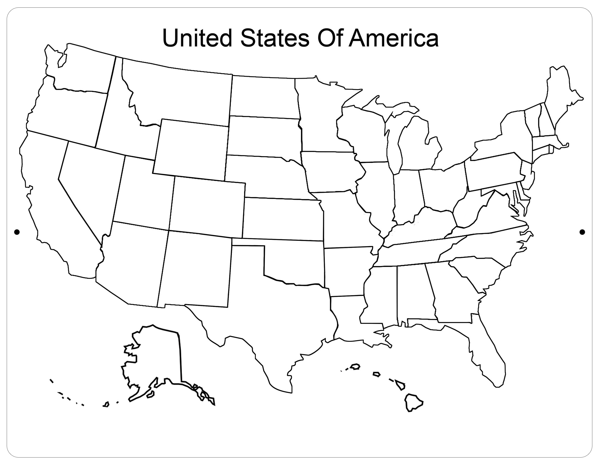
Get the USA Map for Easy Learning
Using a blank US mapto teach geography to kids is an excellent idea. It helps reinforce the position of the states for the young one so that he or she learns the name of every single state. You can find different kinds of United States mapproducts online these days. Which one is better? According to experienced teachers, you will benefit from something more permanent than a mere paper map. One of the biggest disadvantages of these is that they are single-use ones. The state outlines are marked. Your kid puts the names of the states, and that’s it. You will need a new map again.
Repeated use maps
This is where the benefits of an aluminum blank map of the United States are evident. Provide the child with a dry marker and ask him or her to label the various states. At first, you will have to work with reference to memorialize the names of all the states. The United States has a total of 50 states. So, learning the names of all the states is going to take some time.
You will also have to explain what a contiguous state is. Show the position of Alaska in the far northwestern part. Children tend to find it easy to identify the location of Hawaii in the mid-pacific. The blank United States map features all these locations. Children can learn about the locations by repeatedly practicing the names. Apart from the states, there are five major territories and several islands, all outlined on the map.
Learning the state names
Learning the state names is vital for every young student. Therefore, an aluminum USA map of states should be a staple feature in every primary classroom. Students learn by a group experience. So, when one student is trying to commit to memory the names of the different states, others in the class are also learning. In case the student on the map makes a mistake, there’s usually another student who is quick to point out the mistake. It presents an amazing opportunity for group learning.
Teachers often advise parents to have a map of the United States of America at their home. In this way, students can continue their learning efforts at home. It also presents a fantastic chance for bonding between parents and children. By continuously practicing the names of states and territories, students can develop a closer sense of attachment with their country. As you can see, a simple map of United States of America is helpful not only for the academic improvement of the student, but it also strengthens the bond with other students, teachers, and parents.
How to teach state names
How to teach state names using the blank USA map? The usual approach to start is to mark the home state on the map of USA. Students can automatically relate to where they are. Then, you proceed with the neighboring states. Don’t forget to teach the abbreviations of the states, though. It is easier to remember that way. Parents can take a slightly different approach in helping their kids with the blank map of USA. You start with the home state, continue to the neighboring states, and then follow up with states where you have your relatives living.
If you have taken your child to travel to different states, you can teach their names along with the neighboring states. Remember, the key is to keep practicing. Use the dry marker to write the names of the states on the map of United States. Once your child is familiar, you erase the markings and ask him or her to write down the names again.
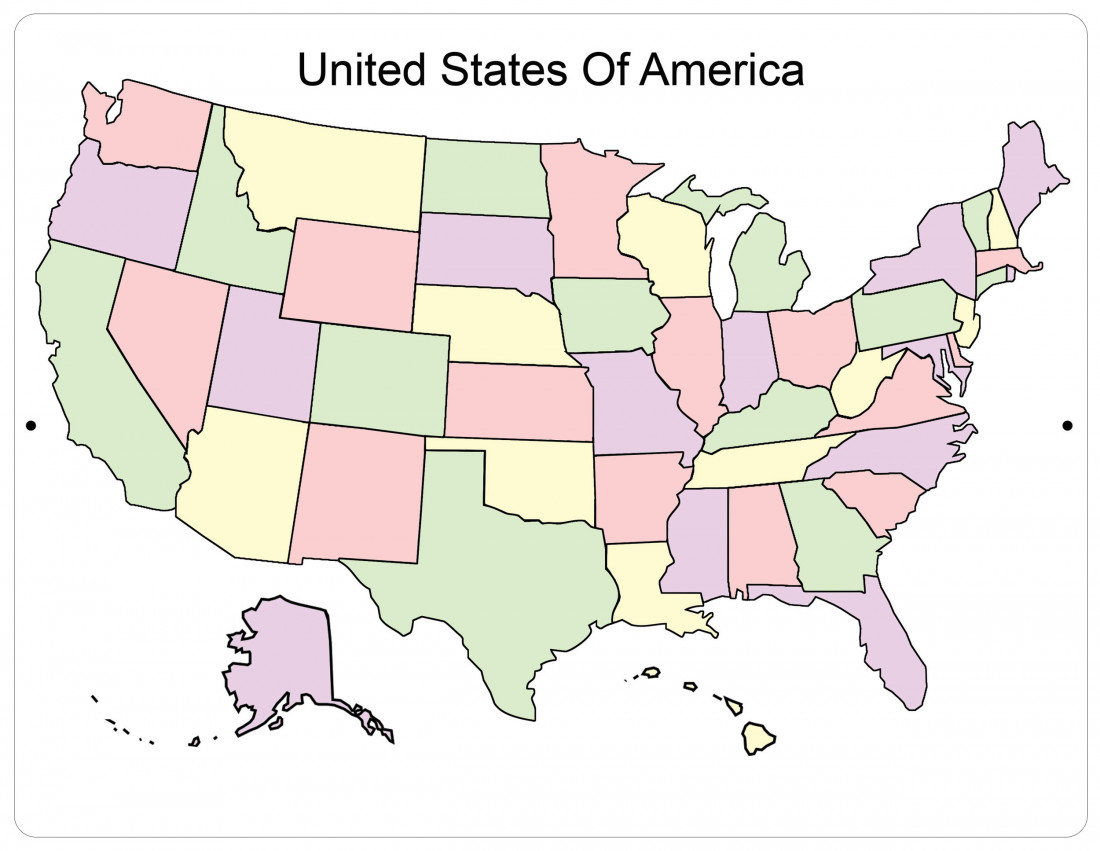
Teaching by regions
Another way to teach young students is to help them remember the states by their regions. The five regions are the Northeast, the Midwest, the Southwest, the West, and the Southeast. It has been found that by classifying the regions on the United States outline, it is easier for students to grasp the concept. As the regions become familiar, you can further improve the teaching method by helping students learn the major geographical features. Here are some examples.
- Which state has the Grand Canyon? Present images of the Grand Canyon and show Arizona on the map. Students will automatically learn the place.
- Which state is famous for casinos? You can show Nevada on the map. Show pictures of Las Vegas. Students will be able to remember it easily on the US map blank.
- Which state has the national capital?
- Which state has the Mississippi river?
- Where are the Appalachian Mountains?
- Where are the Rocky Mountains?
- Where is the Sierra Nevada?
These are just a few examples. Teachers and parents can develop their own sets of questions to show on the map of USA with states.
Teaching with the help of TV
The weather channel on the TV is a great way to help students remember the United States of America map. They show it every day, and hence it is a great way for parents to help students familiarize themselves with the map of the United States. Major weather events such as hurricanes are shown on TV as satellite images on the US map with states. This can help children get a basic idea of geography.
Being patient with the teaching methods
It is good to remember that the child will not memorialize the entire blank map of US in a few days. It usually takes a few months of practicing on the United States map blank. The standard size of a black and white aluminum map is 9 inches by 12 inches. This blank state map allows enough space to write down the names of the states. Teaching state abbreviations will make the process easier.
You can also use dry markers of different colors to help children remember the particulars on the map. States with mountains and hills can be marked in brown. Forested areas can be marked in green on the USA outline. The key is to be patient. Correct the mistakes and encourage the children to do it right again. Repeated practicing will soon make the entire map come alive in memory.